Mercer Island implements ‘Wayfinding’ signs
Published 1:30 am Friday, June 7, 2019
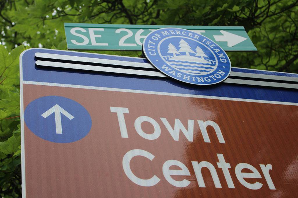
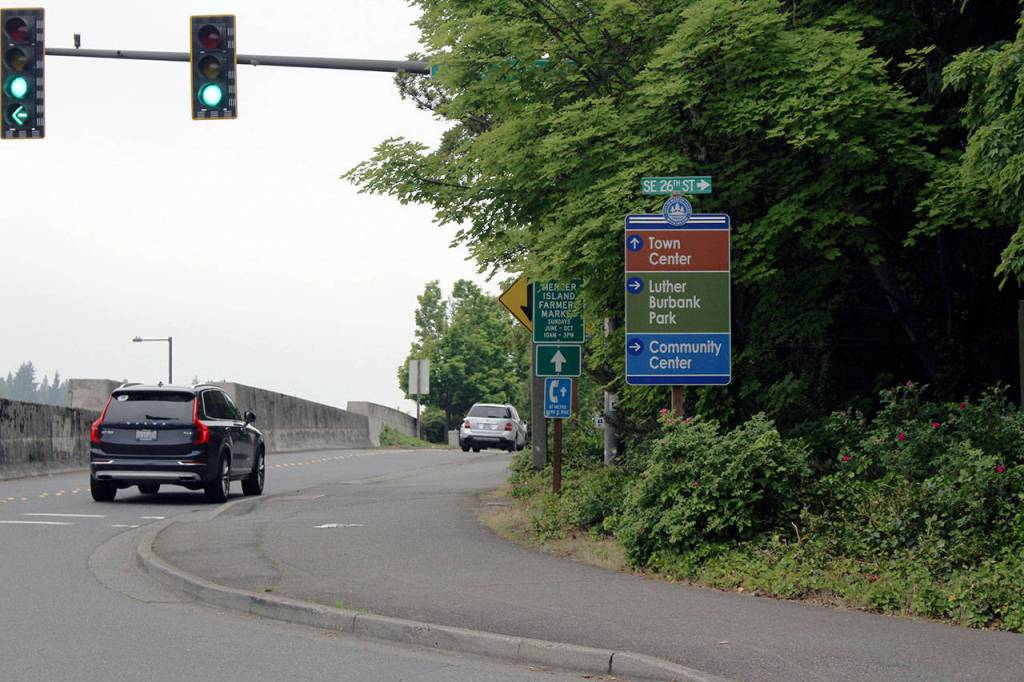


The city of Mercer Island recently installed 16 new “wayfinding” signs around the city, highlighting local parks, points of interest and the Mountains-to-Sound regional trail.
Originally designed in 2017, the new signs were installed to supplement and replace the previous, limited signage that had gone missing or was simply small and low-contrast, according to the city.
“Using uniform messaging and clear visuals, the signs are intended to direct visiting motorists to the Town Center and other key locations, as well as guide pedestrians and bicyclists from the Mountains-to-Sound regional trail to local amenities, businesses and attractions,” said Ross Freeman, Mercer Island’s sustainability and communications manager.
The new wayfinding signs were designed with input from community members, Mercer Island Chamber of Commerce stakeholders and consultant support.
“The designs went through several revisions and improvements that were informed by stakeholder meetings, community comments, a public open house and enthusiastic support from the Chamber of Commerce,” Freeman said.
Mercer Island received a $25,000 economic development grant from the Port of Seattle to fund the signs with the city itself contributing an equivalent amount in field crew labor. The grant funding was specific about eligible projects, and the city already had been discussing the need for wayfinding signage for several years, Freeman said.
According to the city, many of the old signs had disappeared in the previous 20 to 30 years, leaving Island visitors without a guide to local amenities and attractions.
“Quite frequently visitors arrive at City Hall looking for the Community Center, and vice versa,” Freeman said. “Also, many off-Island users of the Mountains-to-Sound Trail do not realize how close by services are to the trail.”
Specifically, the city was worried locals and visitors who traversed the 90-acre Aubrey Davis Park would miss some of the key locations and services on the Island.
Currently, Aubrey Davis Park, which sits along a 2.8-mile stretch of Interstate 90, is undergoing a master planning process and locals can provide feedback on related projects at the city’s website, http://www.mercergov.org/page.asp?navid=613. The city plans to solidify a final master plan between October and December this year.