New Web map opens up city data to Islanders
Published 11:38 am Tuesday, July 7, 2009
As of this week, citizens can look up Mercer Island property lines, city utility sites, neighborhood EMS and crime statistics as well as aerial photographs of the Island dating back to 1946 on the Mercer Island city’s Web site. The new service is called MIMaps and was recently launched by the city’s Geographic Information Services (GIS) department in an effort to share city data with the public.
“GIS and the city have come to a point where mapping is much easier now. We’ve developed a lot of information and layers of data over the last 15 years. We’re at a point now where we can share this information with the public,” said GIS mapping analyst Leah Llamas.
The Web page was also designed to help relieve city employees’ workload. According to Llamas, the most common citizen request that the city receives is information on private property lines.
“Residents come in every week with these questions. We felt we could share this [data] with the public so they don’t have to come to the city for property lines, aerial photos and City Improvement Plans [CIPs],” she said.
Although the Web site is not interactive, there are multi-layered options for viewers to choose. A citizen can search any city address on Mercer Island, and a virtual map with its property lines will pop up. The legal property lot, individual residence, city buildings and parks are shaded for distinction. The property taxpayer’s name is also included.
Residents can then view that same property as an aerial photograph from 2007, 2005, 2002, 1999, 1992, 1978, 1963 and 1946. The difference between the developed Island neighborhoods of 2007 and the expansive greenbelts of 1946 is fascinating.
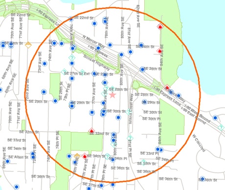
Prospective Island residents can also use MIMaps to research neighborhoods that they may consider moving into. Crime statistics, which include auto, property, violent and miscellaneous crimes, appear on the map as individual dots. The statistics are updated weekly, according to Llamas, and date back some six months.
Web browsers can also look up fire, EMS and police calls in Island neighborhoods. Specific data on these incidents, however, is not available on MIMaps.
MIMaps is currently a static Web site, but the city hopes to create an interactive service in the near future.
“As we get feedback [from the public], we’ll be introducing tools and trying to get the site more interactive. We’ll use our time wisely to develop a new map that’s more specific to people’s needs,” Llamas said.
MIMaps was developed and funded as part of the GIS department’s development plan. The project cost less than $6,000, Llamas said. The city uses a more complicated and interactive mapping network within its own system. Data that cannot be obtained through MIMaps can be acquired personally with city employees, as was formerly the procedure with all municipal information.
MIMaps can be accessed directly by going to http://mimaps.mercergov.org, or look for the MIMaps link on the City of Mercer Island Web site at www.mercergov.org.